Pages 17-20
[ State Capital Building]
CHAPTER I.
APPEARANCE OF THE GREAT BASIN.
Its Condition--Strange Freaks of Nature--Valley of Death
Gnome Lake--A Mountain Lake--Bottomless Fountains--
A Fish Story--Caves-Rivers--Hot Springs--Salt Mountain
and Plains--Foot-prints of a Pre-Historic Race--
Evidence of Ancient Inhabitants.
IN the convulsions that caused nature to thrust from beneath the ocean
the Rocky and Sierra Nevada Mountains, there was left between them an
immense basin, hundreds of miles in width from east to west, and of much
greater length from north to south. This basin was elevated at the same time
a little at the south, barely coming out of the ocean at the mouth of the
Colorado River, while at the mouth of the Rio Virgen it has reached 800 feet
above the Bea, at St. Thomas 1,115, at Hiko 3,760, at Dayton 3,850; the
elevation increasing as the north is approached, the average altitude being
about 4,000 feet. The section is not, however, an unbroken plateau; but on
the contrary, over one-half of its Surface is covered by rock-ribbed
mountains whose lofty peaks, grand slopes, and immense dimension of
foot-bills seem, to the casual observer, to occupy most of the face of the
country. The general trend of the mountains is from north to south.
ITS CONDITION.
In our time-it may not have been always thus -- nature deals out with a
sparing hand her cloud gifts of water over this vast country, and the little
that comes, gathered into streams, flows towards the interior where it forms
lakes and then evaporates or sinks away into the earth. The surface of the
valleys is largely composed of sand, some of them having an alluvial deposit
and all requiring a large quantity of water to make them produce vegetation.
The lofty Sierra Nevada, bordering the basin on the west, intercepts and
exhausts the moisture of the air currents ever flowing eastward,
consequently they pass comparatively rainless over this broad region,
notwithstanding many of its mountain ranges and lofty peaks attain an
altitude of 10,000 and 12,000 feet above the sea. Because of this, mountains
are generally treeless and the valleys barren and desolate to look upon. It
is not a natural home for the husbandman or a grazier’s paradise, but
the miner who seeks an El Dorado will find it here. Yet there are many
valleys and mountain nooks rendered exceedingly fertile by irrigation, and
large herds of cattle range over the hills and plains of the north and east.
STRANGE FREAKS OF NATURE.
Nature was in her eccentric mood when forming this region, and turned
out some strange results from the store-house of time. There is one valley
thirty miles long, just without its borders, lying near the line separating
California from Nevada north of the 36th° of latitude, that is 175
feet below the level of the sea. The Amargosa River, rising in Nevada, flows
uselessly into it, where the burning rays of the sun licks its volume up in
vapors until it becomes a creek and then loses itself upon the parched sands
of a waterless river bed. It is a vast, treeless, waterless, alkaline field
of Tartarus, where heat , and drought, and desolation have combined to drive
the traveler mad with thirst and despair. Over its white, crusted,
inhospitable bosom are now bleaching the bones of animals and men
unwittingly lured there to perish with the horrors of tantalus, and the
place is known as the “Valley of Death.”
There is a subterranean lake in Ruby Mountain that is the source from
which flows, into the valley of that name, the little stream known as Cow
Creek. The entrance to this hidden sea of the Mountain Gnome, is through a
natural tunnel about six feet long, that is large enough to admit only one
person at a time. The entrance leads to the margin of a beautiful sheet of
clear, cold water one hundred feet long by fifty feet wide. At its further
extremity is a sand-bar fifty feet across, beyond which is a rock partition
that comes down within two feet of the water’s surface. Beyond this
partition lies another, smaller lake, from the further side of which leads
off a narrow cave with perpendicular sides, through which the water flows
into the lake. This cave has been explored for some distance until an abrupt
turn was reached, when the explorers fearing to proceed further, returned,
and left the mysteries of what lay beyond a secret still. The torch-light in
passing over these subterranean waters in a boat unveils a scene of weird
and enchanting beauty. From the cavernous, over-hanging walls, reach down
immense, white, gem-decked, stalactite sentinels, pointing towards the
unrevealed depths of that beautiful, silent, silvery. sheet of water that
hides from the visitor the remains of one who lost his life, in 1865, while
seeking to learn these hidden mysteries. Should it not be called “Gnome
Lake” ?
On the summit of a high mountain in this Ruby range is another beautiful
lake, higher than Lake, Tahoe, probably the highest in the world, thus set
“up in the region of storms,” ofttimes remaining frozen over until July.
An outlet from it towards the east feeds a stream that, leaping down from
the rocky heights, flows out into Ruby Valley, and is known as Overland
Creek.
Of the discovery of this lake, and the dread in which it is held by the
Indians, Charles Stebbins, of Austin, relates that in 1862 he went in search
of a pool of water that the Indians located upon the summit of a high, bald
mountain in the Ruby range about thirty-five miles north from the old
overland station. To the red men it was a mystic spot, over which an evil
spirit ruled, whose home was in those, waters. This dread spirit was never
seen except in the form of a large fish, and whoever saw that fish went away
to linger for a time and die. Sho-kub, a chief of the Shoshones, died
of consumption in the fall of 1861, at the trading-post kept by Stebbins;
and during his illness, often spoke to the latter concerning this pool of
death in the mountains. Sho-kub warned his white friend against visiting the
spot, claiming that he had seen the fish that no person had ever looked upon
and lived. The curiosity of Stebbins having been excited by the strange
stories concerning the locality related to him by the chief, determined to
see the spot so dreaded by the aborigines. Accordingly, in company with the
famous pioneer and frontiersman, Wm. H. Rogers, “Uncle Billy,”
he went in search of it:
As we approached the spot-said Stebbins the rocks began to give out a
strange, hollow sound as though we were passing over a cavern, and fearing
we would break through, we got down upon our hands and knee is and crawled
along. At length we came to the mouth of a yawning chasm, and looking over
the rim saw about twenty feet beneath us the smooth face of glistening
water. The opening at the top was possibly forty feet across, circular in
form, and the interior view was like looking into the small end of a funnel.
After taking a good look we went down to where our horses were, and camped
for the night. The next day we went back and took another look, but we saw
no fish. In the immediate vicinity we found large numbers of fossil shells.”
“I cannot tell how the truth may be,
I say the tale as ’twas said to me.”
At the northeast end of this same range of mountains, in the valley near
the railroad town of Wells, are apparently bottomless fountains of water
miles from any surface stream. It is but a few feet across the largest of
them, the smaller could be crossed at a bound, and all are peopled with
swarms of little fish, none of them over four inches in length. One hundred
and seventy miles to the southwest are other wells in which can be found
similar specimens of the finny tribe, but they exist nowhere else upon the
continent. From what age, and Condition of the past are they the relies ?
In the northwestern part of Nevada is a millstream of water, in which
are numerous fish. A hot spring near its banks boils out of the rocks and
flows across it; the two eventually mingle together. The angler standing
where the water from the hot spring first reaches the stream and flows out
over it, has but to drop his bated hook down through the hot into the cold
current, catch a fish, raise it into the upper stratum, and eventually draw
it forth ready cooked for eating.
Caves are found in various places; among the most extensive, strangely
peculiar and accessible, is one in the Star range of mountains, east, a few
miles from Humboldt Station on the Central Pacific Railroad. In those
mountains, on the summit between Star and Santa Clara Cañons, stands a
high, bold, limestone cliff. Its south front presents a perpendicular face
200 feet, high, and fifteen feet from its base is the entrance to the cave,
through an opening six feet high and six feet wide. This cave has been
explored for a distance of 2,500 feet in a northerly direction, but the end
has never been reached. It is represented, by those who have visited it, as
being of strange and wondrous form, of numerous galleries and chambers,
where one could easily imagine that he had entered the realms of the
Olympian kings, whose castle walls were decked with amethyst and crystal
spar. There are numerous galleries carpeted with their wealth of salt, of
soda, of borax and alkaline substances, so often met with in this region.
The streams partake of the general characteristics of the region. The
Humboldt, rising in the mountains of the northeast, winds its way among the
mountains in a general course to the southwest, over 300 miles, and pours
its waters into an inland lake, where they sink away in the sands, or
evaporate under the sun’s hot rays. The Truckee, made from the
overflow of Lake Tahoe up in the Sierra Nevada in California, rushes away
down the mountain to the northeast and becomes feeder to Pyramid Lake. The
Carson River, also rising in California, courses down in a rushing,
turbulent stream through the cañons in the eastern slope of that chain
of mountains, and stretching away through the valleys and foot-hills to the
northwest, forms a lake and disappears near the Humboldt. The Walker River,
also starting from California, flows by a circuitous route into Nevada, and
forms a lake bearing the name of the river. Reese River-that should have
been called a creek-flows north, begins and ends in the interior. The Great
Salt Lake of Utah is fed by many streams flowing from the mountains in the
east; and all those lakes, taken in connection with the numerous other
reservoirs, are but the inland depositories for the great water-shed of this
immense basin, among which are Utah, Sevier, Mono, Owens, Honey, Eagle,
Lower, Middle, Upper, Abert, Summer, and Silver Lakes. But one stream rising
in all this region north of the Colorado Basin, seeks the ocean as an
outlet, and that is the Owyhee, which, flowing through the channels of Snake
River, eventually mingles its waters with the Pacific.
Hot springs are found in many parts of the State, some of which are very
singular in their character, and many exceedingly valuable as resorts for
invalids. Of the best known of these, are the Steamboat Springs, eleven
miles south of Reno, in Washoe County, on the road leading from Reno to
Virginia City. These cover a space of a mile or more in length, and a third
of a mile in breadth. This area is always covered with a cloud of steam,
springing in jets from apertures in the rock, resembling the escape from a
high-pressure engine-hence the name.
In the valley of Walker River, ten miles from Wellington Station, are
the singular and valuable Hind’s Hot-Springs, discovered by the
present proprietor in 1860, and bearing his Dame. These have become a
popular resort for invalids and tourists, who enjoy the luxury as well as
the medicinal qualities of the baths.
The great hot spring of Smoky Valley, in Nye County, is wonderful for
the high temperature and abundant flow of its waters, more than from any
medicinal quality they contain. The spring is situated in the midst of a
broad plain, its column of steam giving to the passing traveler the only
intimation of its presence. A great shaft in the earth, fifty feet in
diameter at the surface, out of which rises a stream of boiling water,
bubbling at the center like a cauldron over a furnace, and flowing but a few
hundred yards in the plainj at first a considerable stream, then
disappearing-ever a mystery. The water is fresh and potable when cooled, or
is used in tea or coffee, which beverages are readily prepared by it use.
Here is a favorite camping place for travelers and prospectors, the boiling
pot being perpetually in readiness for culinary purposes, cooking potatoes,
or other comestibles immersed or suspended in the water. Eastward, in the
same county, is Rot Creek, flowing, as its name implies, a stream of hot
water from several springs of that character. Near Elko are a number of hot
springs, which are regarded as great curiosities, and much resorted to by
invalids. Near the line of the Central Pacific Railroad, about twenty miles
east of Wadsworth, is a group of hot springs that have attracted the
attention of many travelers, and were the wonder of the early emigrants
crossing the desert to California. Others, throughout the State, are too
numerous to name in detail.
The evidences left of -nature’s strangest freak in this singular
land, consists of -a mountain of salt that is found twenty-five miles north
of the Colorado River, and a little west from the Rio Virgen, much of it is
chemically pure, transparent as water, and so hard, that to remove it
requires blasting. The mountain is nearly two miles long, a half mile wide,
and its summit reaching about five hundred feet above the level of the
surrounding country. The surface is covered by a coating of earth, the salt
lying in a vast stratum, nearly one hundred feet in thickness through the
entire mass. Blocks of this salt have been used as windows by the Mormon
settlers in the neighborhood.
Extensive beds of the same material are found in every quarter of the
State, sometimes the salt forming as an efflorescence on the surface of the
ground, and at others, found in large crystallized blocks by excavation.
Beds of bi-carbonate of soda, boracic acid, sulphur, alum, and kindred
substances, best known to the chemist and druggist, are found in many
localities.
FOOT-PRINTS OF A PRE-HISTORIC RACE.
Evidences of the existence of a race of people, not there now, is found
in various places between the Rocky and Sierra Nevada Mountains. A few
observations will be given, leaving the future archæologist to explain
their occurrence. There is a place on the Carson River where that stream
cuts off the point of a foot-hill around which, it sweeps at the lower
terminus of what is known as the Big Bend, possibly one mile up the river
from where once stood the Williams, or Honey Lake Smith’s, Station.
The place where the hill is cut by the stream gives a facing to the west
that overlooks the desert and the country to the South. Up along the face of
that cut, there are figures, or characters, chiseled into the hard rocks,
that can be seen by the hundreds. Spiral forms, rings, and snakes, are the
predominating characters; several triangles, one well-formed square and
compass, and the form of a woman with out-stretched arms holding in one band
a branch, was noted among the number. Similar characters are found in
Arizona, New Mexico, Old Mexico, and Central America. The Indians of the
vicinity have no knowledge concerning them, not even a legend.
Since seeing this art gallery, that speaks from a time unknown and of a
lost race, futher inquiry has disclosed the fact, that the same class of
rock imagery was to be seen by the early prospectors, in Star Cañon on
a bluff below the Sheba Mine, in what is now Humboldt County.
Dr. S. L. Lee of Carson City reports that in Condor Cañon, ten miles a
little east of south from Pioche, there are about fifty figures cut in the
rocks, many of them designed to represent the wild mountain sheep. Still
farther south, possibly eighty miles from Pioche, in the Meadow Valley wash
near Kane Springs, this class of pre-historic art is most numerous and
perfect in design. Men on horseback engaged in the pursuit of animals are
among the most perfect and probably modern of the designs at that place. The
Indians in that part of the country having some superstitious belief
concerning them, or having no theory of their meanimr, refuAe to talk upon
that subject with the whites. The following is an extract from the Eureka
Leader of February 14, 1879:
EVIDENCE OF ANCIENT INHABITANTS.
Mr. Walker who has been working in the newly opened stone quarry, near
the mouth of Now York. Cañon, brought a Singular and interesting
specimen to the Leader office this morning, the same being a slab of
sandstone about twenty inches long, fourteen wide, and some three inches
thick. The peculiarity of the rock is in the imprint upon its surface of a
gigantic foot, perfect in shape and contour with the exception of one toe,
the little one, which is missing. By measurement it is fourteen and one-half
inches from the outer rim of the heel to the end of the great toe, and six
inches wide on the ball of the foot. The print is sank into the rock
one-half inch. Mr. Walker claims to have taken it from the top of the
sandstone formation at a point where about two feet of sand rested upon it.
The rock is firm and hard in texture and forbids the idea of its being
artificial work.
The reader’s attention has already been called to the existence of
a salt mountain in southern Nevada. The following concerning the
pre-historic evidence of that locality is from the pen of Daniel Bonelli:--
The salt mines are solid ledges of rock salt of great extent, and
containing salt enough to run one hundred quartz mills for one thousand
years. Some of the ledges on which I have had work performed for myself and
the Southwestern Mining Company of Philadelphia, who are part owners, have
an opening showing below the cap rock, some ten to twenty feet below the
surface, charcoal, corn-cobs, bones, arrows and cedar-bark matting woven
into blankets, giving undisputable evidence that long ages ago the
pre-historic man dwelt in the eaves here, which the dust of time has since
covered and indurated.
Large trees, petrified and scattered over the face of the country, show
that more moisture existed upon this land long ago than there is now, and
what may once have been a fertile country is now desert and an appalling
desolation. A few small margins of fertile soil along creeks or springs are
all that even now makes human or animal life possible, and even the great
Colorado of the West, which sweeps along the line of the State, bringing its
waters from the snowy summits of the continent to the world’s greatest
ocean, does not redeem the desert character of the land, for it has carved
its pathway through huge mountain chains in mighty gorges, and shows so few
margins of arable land that no settlements of importance are sustained at
present on its banks.
Evidences of a less remote occupation of this country is found in the
pottery discovered, and rude fortifications yet traceable in the region
lying north of the Colorado River, and along the streams emptying into it.
The pottery is of a dull white ground, with black stripes running up and
down, the Moqui Tribe of Arizona having in use at the present time the same
kind of earthern jars. Another exists in the remains of an old irrigating
ditch along the Virgen River that shows an advanced knowledge of husbandry.
The ruins of adobe houses still exist at a spring on the east side of Ash
Creek, in the same section of country. The remnants of an old well, and
blocks of hewn granite at Pah-Tuck Springs also speak of a civilization
there that has ceased to exist.
|
|

 Next
Next 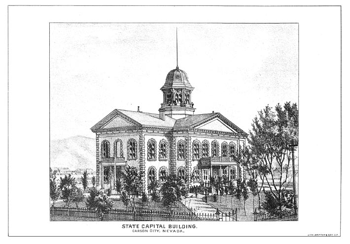